
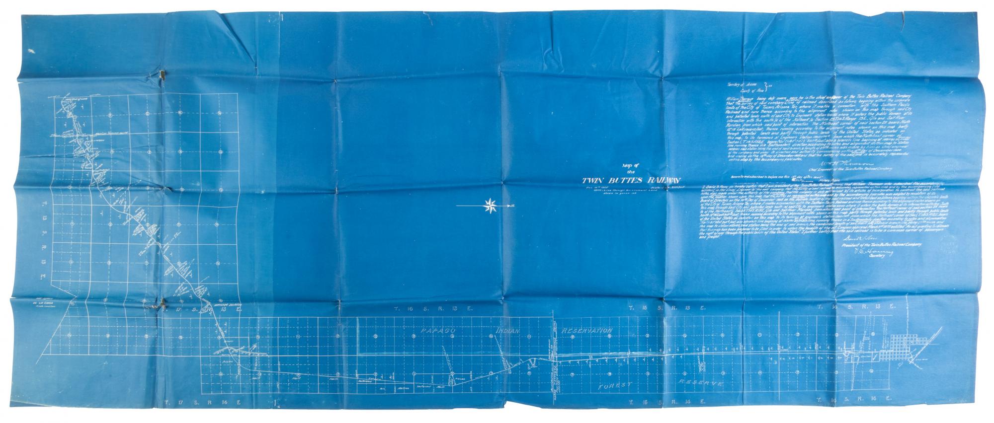
MAP OF THE TWIN BUTTES RAILWAY
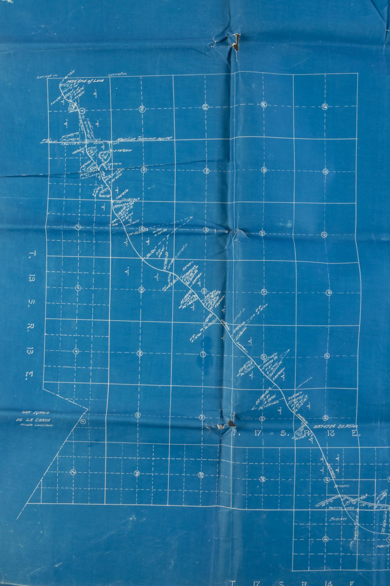
Mammoth blueprint map (approximately 27” x 66”), dated December 14, 1905, showing the route of the Twin Buttes Railway as it was originally proposed and surveyed. Construction of the railroad was completed in 1906, connecting the mining town of Twin Buttes to Tucson and the Southern Pacific’s Tucson-Nogales line at nearby Sahuarita.
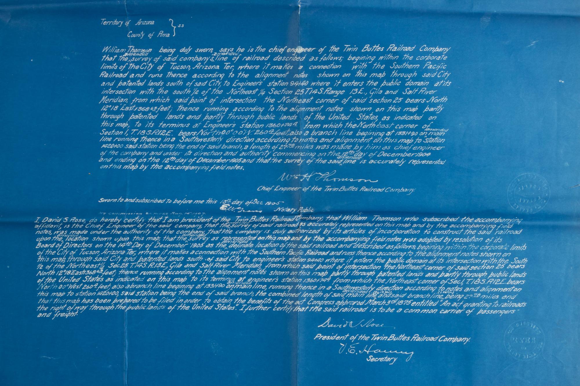
Copper was discovered at Twin Buttes at the turn of the last century, and commercial mines were opened in 1903, operated by the Twin Buttes Mining and Smelting Company. The railway ran until the late 1920s, when mining in the Pima District declined precipitously, and Twin Buttes became a ghost town. This map provides an extremely detailed chart of the route, with Tucson at the lower right corner and the end of the line at the mining camp in the upper left. In the upper right area of the map, statements by the chief engineer, William Thompson, and president of the railroad, David Rose, swear to the accuracy of the survey, which has been approved by a notary public.
An excellent cartographic document of a transient mining town and its railroad in pre-statehood Arizona. Folded, with some minor closed tears; otherwise very good. Scarce, OCLC locates only one other copy of this map at the University of Arizona. Very good. Item #73889
Price: $850.00