KENT COUNTY, ENGLAND ARCHAEOLOGICAL MAP OF SAXON RUINS
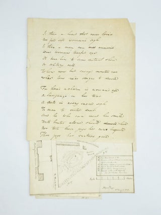
A hand-drawn map entitled “A Plan of a Roman Barrow and Earth Works at White Heath in the Parish of Hollingbourne in the County of Kent Opened 26 July 1842 on the Estate of Charles..... More
A hand-drawn map entitled “A Plan of a Roman Barrow and Earth Works at White Heath in the Parish of Hollingbourne in the County of Kent Opened 26 July 1842 on the Estate of Charles..... More